- Welcome to Great Lakes Bass Fishing Forum.

Michigan and Great Lakes Bass Fishing Forum

 Shoutbox
Say Hi or something!
The Ultimate Sport Show Grand Rapids is March 13 - March 16 next week!
Please visit booth 1929 back by The Hawg Trough to say hi and wish me happy birthday while you're at it! 
Stop by booth 5767 near the west end of the Suburban Collection Showplace to keep me company at Outdoorama February 20-23.
Next up - Outdoorama in Novi February 20-23, 2025! See you there!
I might be at a seminar for a bit but I'll be around.
Advertisement
Recent Topics
-
 Prop repair
by djkimmel
Prop repair
by djkimmel
[April 09, 2025, 10:52:13 AM] -
2025 SWAPMEET
by djkimmel
[March 19, 2025, 03:25:37 PM] -
2025 Ultimate Sport Show Grand Rapids Volunteers Schedule
by djkimmel
[March 04, 2025, 04:49:00 PM] -
KVD and Z Again at 2025 Ultimate Sport Show Grand Rapids
by djkimmel
[March 04, 2025, 04:44:42 PM] -
 Lake St Clair Spring Smallmouth Bass Fishing
by Bigbass201
Lake St Clair Spring Smallmouth Bass Fishing
by Bigbass201
[February 28, 2025, 02:41:03 AM] -
Lake Leelanau Spring Smallmouth Bass Fishing
by Bigbass201
[February 21, 2025, 04:09:07 AM]
Latest Articles
Fri, 04 Apr 2025 16:46:33 +0000
Now is the best time to be a bass angler on Lake St. Clair in at least the last 50 years according to a recent long-term MDNR fisheries research study.
Fri, 04 Apr 2025 16:00:54 +0000
Due to low water levels on the Great Lakes, particularly Lake St. Clair, the mouth of the channel at the Michigan DNR Clinton River Cutoff ramp needs to be dredged.
Tue, 04 Mar 2025 17:11:14 +0000
Over 4 Acres of Fishing and Hunting Gear, Fishing Boats, Seminars and more available starting Thursday, March 13 at DeVos Place in downtown Grand Rapids. Many great seminars featuring Kevin VanDam and Mark Zona.
Fri, 07 Feb 2025 20:06:06 +0000
If you enjoy your time in the outdoors – hunting, fishing, boating, camping etc. – then Suburban Collection Showplace is the place for you and your family Feb. 20-23 when the 52nd Annual Outdoorama returns to town.
Fri, 20 Dec 2024 21:45:52 +0000
Hundreds of New Fishing Boats, the largest Ice Fishing Display in the state, and a Star-Studded Lineup of Seminars by some of the best anglers in the world combine to make the 42nd annual Ultimate Fishing Show–Detroit the largest and best Pure Fishing Show in the country.
Advertisement
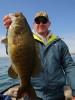
Lake St. Clair
Started by fiker, March 11, 2006, 08:16:49 AM
Previous topic - Next topic0 Members and 1 Guest are viewing this topic.
User actions